Sleet, Freezing Rain, and Snow: Know the Difference
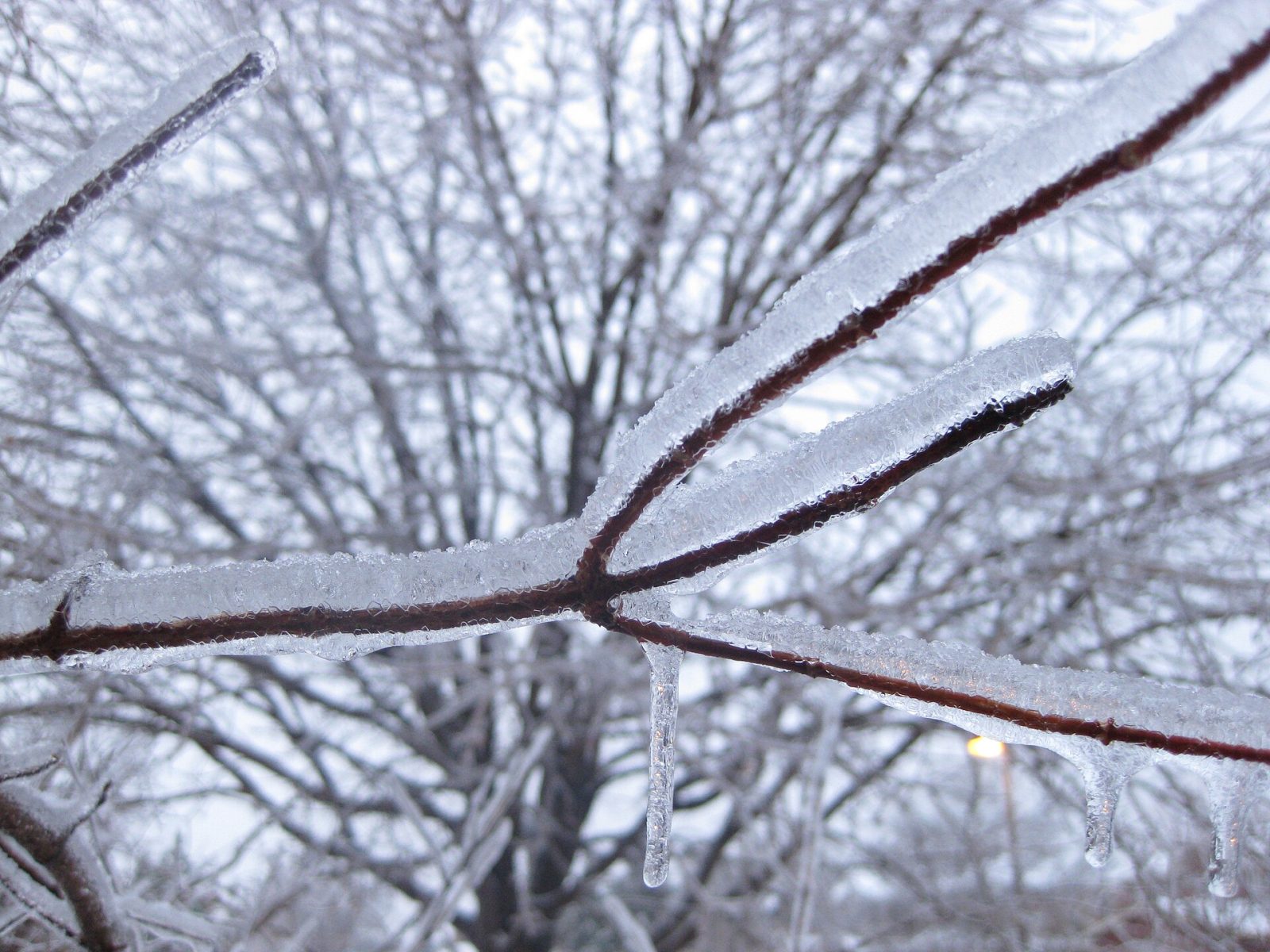
Direct answer: Snow, sleet, and freezing rain all fall from winter clouds, but they are not the same thing — and telling them apart matters, because each one behaves differently on the ground. All of them start as snow high in the clouds. What reaches the ground depends on the temperature of the air between the cloud and the ground: if the air is cold all the way down, the snow stays snow; if it passes through a warm layer, it can melt and then refreeze as sleet, or stay liquid until it hits a cold surface and freeze there as freezing rain. Freezing rain is the most dangerous of the three: it coats roads, trees, and power lines in a sheet of ice, and a quarter of an inch of it is enough for the National Weather Service to call the event an ice storm.
Snow
Snow forms when the air is below freezing from the cloud to the ground. Snowflakes grow in a layer of the cloud called the dendritic growth zone, where temperatures run from 10 to 0 degrees Fahrenheit (about −12 to −18 degrees Celsius) and the relative humidity is 70 percent or higher. The kind of snow you get depends on the temperature near the ground. Dry snow falls when the air is very cold: it is light and powdery and easy to blow around. Wet snow falls when the air is closer to freezing: it is heavier, wetter, and stickier, and it packs into snowballs more easily. Both are snow, but wet snow is the one that weighs down branches and power lines, and it is the one that makes shoveling hardest.
Sleet: ice pellets that bounce
Sleet — also called ice pellets — forms when snow falls into a warm layer of air, partially melts, and then refreezes in a cold layer near the ground. The warm layer is thin, usually less than 2,000 feet thick, and its maximum temperature is typically 34 to 38 degrees Fahrenheit. The result is a hard pellet of ice that bounces when it hits the ground — in fact, sleet is the only kind of winter precipitation that bounces. Sleet usually falls in a narrow band between rain to the south and snow to the north, and it rarely piles up the way snow does: it usually bounces off surfaces instead of sticking, so it is mostly a nuisance. But several inches of sleet can still cause problems on roadways, and it can mix with snow and freezing rain in the same storm, so a forecast of sleet does not mean the roads are safe.
Freezing rain: the most dangerous kind
Freezing rain forms when the warm layer is deeper and warmer, with a maximum temperature above 38 degrees Fahrenheit. The snow melts completely into rain, and then it falls through a shallow layer of freezing air right at the surface. The rain does not have time to refreeze in the air — instead, it freezes the instant it touches anything at or below freezing: a road, a sidewalk, a tree branch, a power line. The result is a smooth coating of ice called glaze. The glaze makes roads and walkways treacherous, and its weight can break tree limbs and pull down power lines, knocking out power for days. The National Weather Service considers an accumulation of a quarter of an inch or more of freezing rain an ice storm. Freezing rain is often the hardest of the three to see coming, because it can look like ordinary rain while it is falling — the danger is what it becomes when it lands.
Graupel and freezing drizzle
Two other kinds of winter precipitation are easy to confuse with sleet. Graupel, also called snow pellets, forms when supercooled water droplets in a cloud coat a snowflake and freeze onto it. The result is a soft, white pellet that looks like a tiny ball of styrofoam — or, as the National Weather Service puts it, like Dippin' Dots. The difference is in how they form: sleet is a frozen raindrop, while graupel is a snowflake coated in frozen droplets. Freezing drizzle is different again: it forms in shallow clouds with limited moisture, falls as tiny droplets, and freezes on impact, the same way freezing rain does. It is easy to miss, because the droplets are small, but it can still glaze a road.
What to do when each one falls
When the forecast calls for snow, expect travel to slow down and visibility to drop, and check the weather alerts page before you head out. When sleet is falling, remember that it bounces and does not stick — but several inches of it can still make roads slick, so slow down and leave extra space. When freezing rain is forecast, stay off the roads if you can: the glaze it leaves is nearly invisible and far more slippery than snow, and falling ice and branches can bring down power lines. If you must go out, treat every wet-looking surface as ice. After any of these storms, watch for the weight they leave behind: snow and ice on branches and wires can bring them down hours after the precipitation stops. For more on preparing for winter weather, see the site's cold safety guidance.
Frequently asked questions
What is the difference between sleet and freezing rain?
Sleet is snow that partially melts in a warm layer and refreezes into hard ice pellets before it reaches the ground, so it bounces when it lands. Freezing rain melts completely and stays liquid until it hits a cold surface, where it freezes on contact into a sheet of ice.
Is freezing rain more dangerous than snow?
Yes. The National Weather Service calls freezing rain the most dangerous type of winter precipitation. It coats roads, trees, and power lines in glaze that is nearly invisible, and just a quarter of an inch of it counts as an ice storm.
What is graupel?
Graupel, also called snow pellets, is a snowflake coated in frozen supercooled water droplets. It looks like a tiny ball of styrofoam. Unlike sleet, which is a frozen raindrop, graupel is a rimed snowflake.
Why does sleet bounce but freezing rain stick?
Sleet is already frozen solid when it reaches the ground, so it bounces off. Freezing rain is still liquid when it falls and freezes the instant it touches a surface at or below freezing, so it sticks and forms a glaze.
Sources
- National Weather Service Twin Cities - Winter Weather Observations
- National Weather Service Amarillo - Winter Precipitation Types
- National Weather Service Baltimore/Washington - DC Winters
About the author
WND Editorial Team — The World Natural Disasters editorial team curates disaster information from official scientific and humanitarian sources, reviews safety guidance against public-agency recommendations, and maintains the historical database.
Written and reviewed under our editorial policy. Factual claims cite the sources listed above.
Found an error? See our corrections policy.