Satellite Before and After
NASA satellite images of the same place before and after a disaster, compared with a
draggable divider. Each case has dated images from the same satellite layer, a plain description of what changed,
the limits of what a satellite picture can show, and the original sources.
In this false-colour view water is dark blue to black, vegetation is bright green, bare ground is tan, freshly burned land is red-brown and cloud is cyan. Each image is one satellite pass at about 250 metres a pixel. It shows where water or burned land is visible from space on that day; it does not measure damage, and cloud or haze can hide what is underneath.
18 case studies, grouped by what the images show, newest event first in each group.
Floods (8)
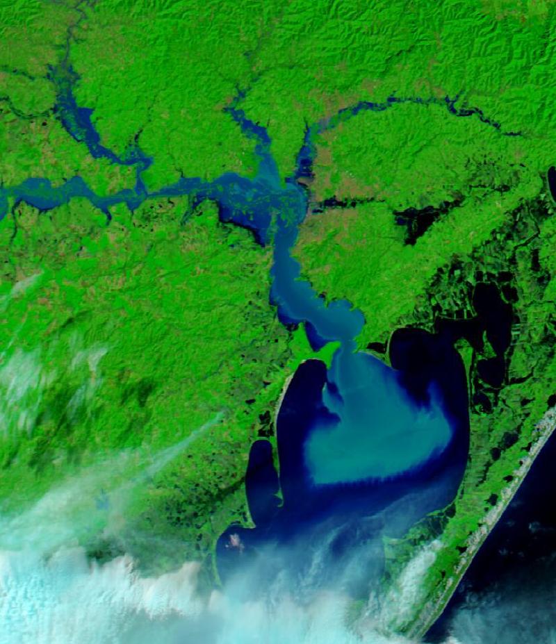
Storms and torrential rain from late April 2024 caused deadly flooding across the Brazilian state of Rio Grande do Sul that lasted through much of May, including in the state capital, Porto Alegre.
Before 21 Apr 2024
· after 6 May 2024
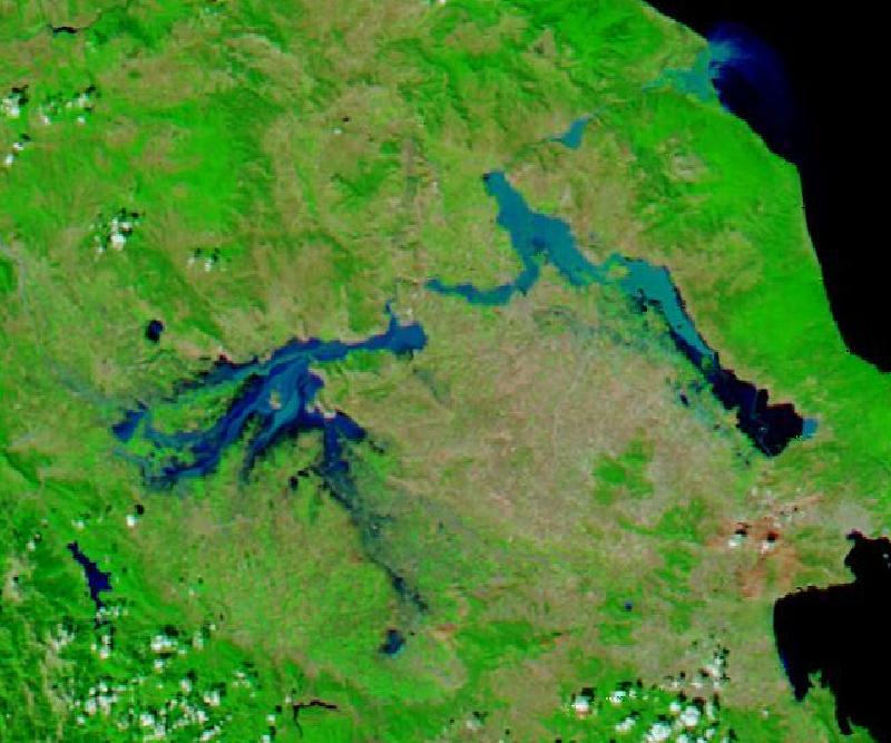
A stalled storm dropped heavy rain on central Greece from 4 to 7 September 2023 and flooded Thessaly, the country's agricultural heartland. The same storm went on to cause the Derna dam floods in Libya.
Before 29 Aug 2023
· after 10 Sep 2023
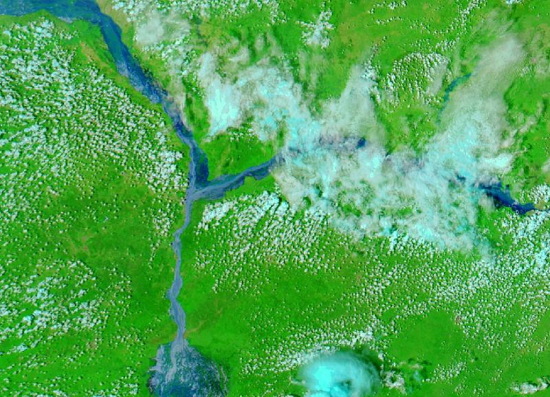
Nigeria's 2022 floods were the worst on record since 2012; near the confluence of the Niger and Benue, floodwater inundated Lokoja, the capital of Kogi State.
Before 15 Oct 2021
· after 5 Oct 2022
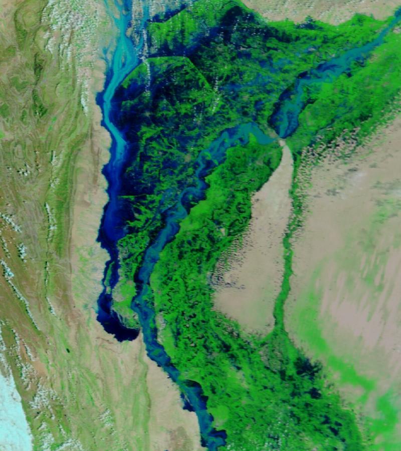
Extreme monsoon rain from mid-June 2022 flooded tens of thousands of square kilometres of Pakistan. The worst flooding was along the Indus, and Sindh province took much of it.
Before 8 Aug 2022
· after 31 Aug 2022
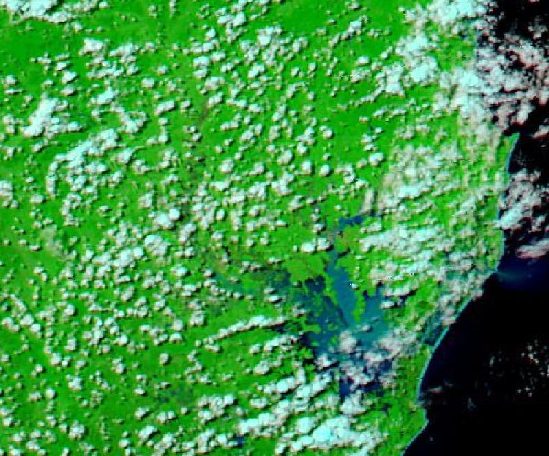
Heavy multi-day rain at the end of February 2022 flooded coastal towns in south-east Queensland and north-east New South Wales.
Before 10 Feb 2022
· after 2 Mar 2022
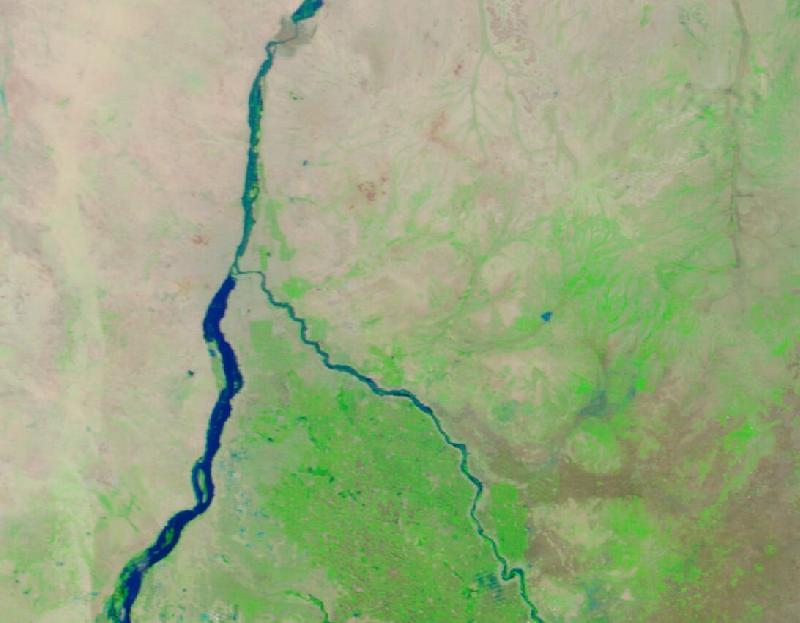
A wetter-than-usual rainy season in 2020 raised the Nile to record levels, and the White and Blue Nile broke their banks in Khartoum and Omdurman.
Before 20 Jul 2020
· after 5 Sep 2020
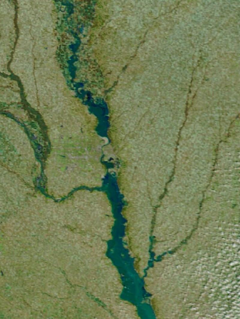
In mid-March 2019 an intense storm brought downpours and warm air onto snow and frozen ground, and rivers across the central United States rose to all-time records.
Before 20 Oct 2018
· after 20 Mar 2019
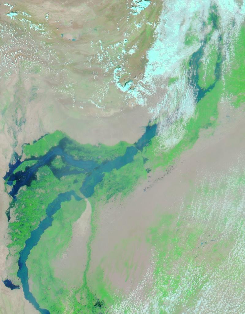
Monsoon rain in late July 2010 sent a flood surge down the length of the Indus, in what NASA called perhaps the worst flood in Pakistan's modern history.
Before 18 Jul 2010
· after 24 Aug 2010
Hurricanes and cyclones (2)
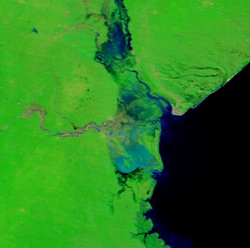
Tropical Cyclone Idai came ashore near Beira in mid-March 2019 and caused catastrophic flooding across Mozambique, Malawi and Zimbabwe, one of the deadliest storms recorded in the Southern Hemisphere.
Before 27 Feb 2019
· after 26 Mar 2019
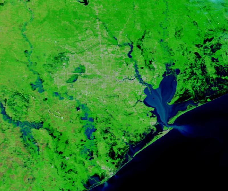
Hurricane Harvey stalled over south-east Texas in late August 2017 and dropped record-setting rain, flooding the coast and the Houston metropolitan area.
Before 18 Aug 2017
· after 31 Aug 2017
Wildfires (8)
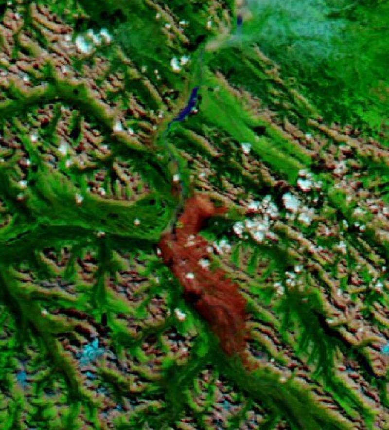
In late July 2024 wildfires in Jasper National Park, in the Canadian Rockies, forced visitors and residents to leave the area.
Before 10 Jul 2024
· after 1 Sep 2024
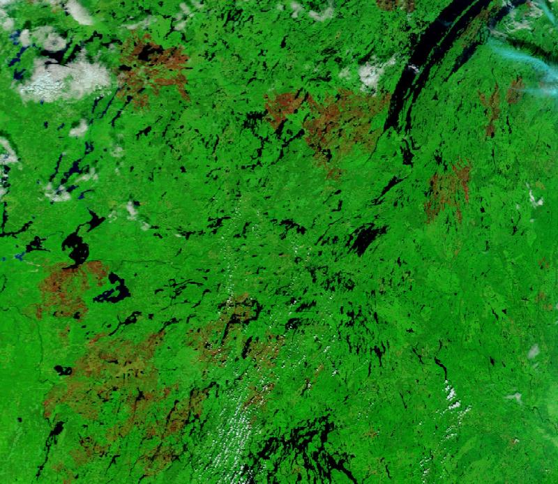
Canada's 2023 wildfire season was the largest on record. In Quebec more than 150 fires, some started by lightning, were already burning by early June.
Before 28 May 2023
· after 5 Sep 2023
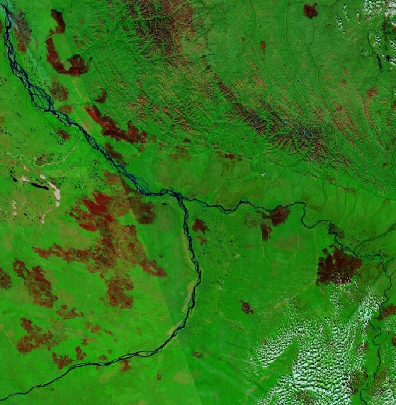
Fires broke out in Sakha as soon as the snow began melting in May 2021 and burned through the summer, in the region's most severe fire season in decades.
Before 10 Jun 2021
· after 1 Sep 2021
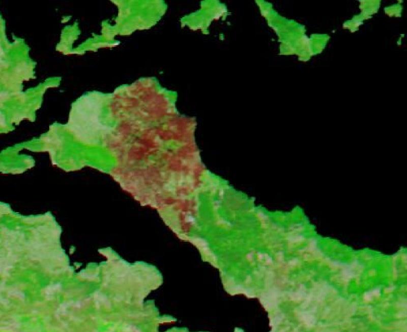
In early August 2021, after one of Greece's worst heatwaves since the 1980s, fires charred a large part of Evia, the country's second-largest island.
Before 29 Jul 2021
· after 17 Aug 2021
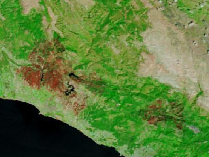
In the summer of 2021 wildfires spread along Türkiye's southern coast, fed by strong winds, temperatures above 40°C and low humidity, including near the resort towns of Manavgat and Alanya.
Before 27 Jul 2021
· after 15 Aug 2021
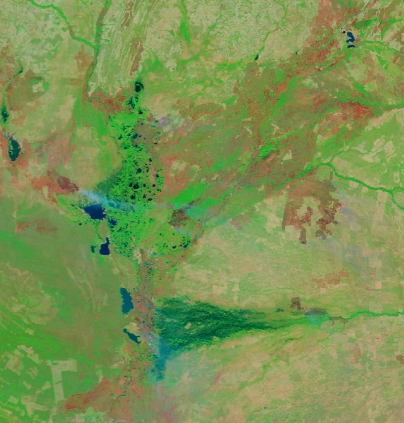
Fires surged across the Pantanal from July 2020, at the start of the dry season, and burned far more of the wetland than in any previous year satellites had measured.
Before 20 Jun 2020
· after 1 Oct 2020
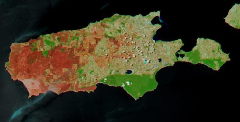
During Australia's Black Summer, bushfires burned across Kangaroo Island, off the coast of South Australia, and destroyed a large share of its native bushland.
Before 14 Dec 2019
· after 21 Jan 2020
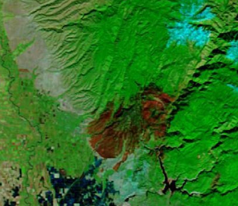
The Camp Fire of November 2018 was the deadliest and most destructive in California's history, and destroyed the town of Paradise.
Before 6 Nov 2018
· after 25 Nov 2018
How the dates were chosen
For each event the imagery was checked on both MODIS satellites, Terra and Aqua, for several days before and after,
and the clearest pass on each side was kept. Cloud is the usual reason a date was rejected: most of the passes checked over Beira
in the week after Cyclone Idai made landfall were cloud, for example. A case is only published when both images show the
ground.
Some events were checked and not published. Kerala's 2018 floods and Cyclone Freddy's 2023 floods in Malawi and
Mozambique were under cloud on most passes checked; the Derna dam collapse in Libya in 2023 is too narrow to see at this
resolution; and in Bangladesh's Sylhet region, where wetlands fill every monsoon, the 2021 and 2022 images looked too
alike to show the 2022 flood fairly. Where a clear same-season image did not exist, a case says which season its
before-image is from.
About the imagery
The images come from NASA's Global Imagery Browse Services (GIBS), which publishes daily global imagery from the
MODIS instruments on the Terra and Aqua satellites. The layer used here, Corrected Reflectance bands 7-2-1, combines
shortwave-infrared, near-infrared and red light, which makes water and burned land stand out from vegetation and
cloud. At about 250 metres a pixel it shows regional change well and individual streets or buildings not at all.
We acknowledge the use of imagery provided by services from NASA's Global Imagery Browse Services (GIBS), part of NASA's Earth Science Data and Information System (ESDIS). GIBS documentation.
All tools → · Historical disasters database →