Lake-Effect Snow: Why One Town Gets Buried, the Next Gets Sun
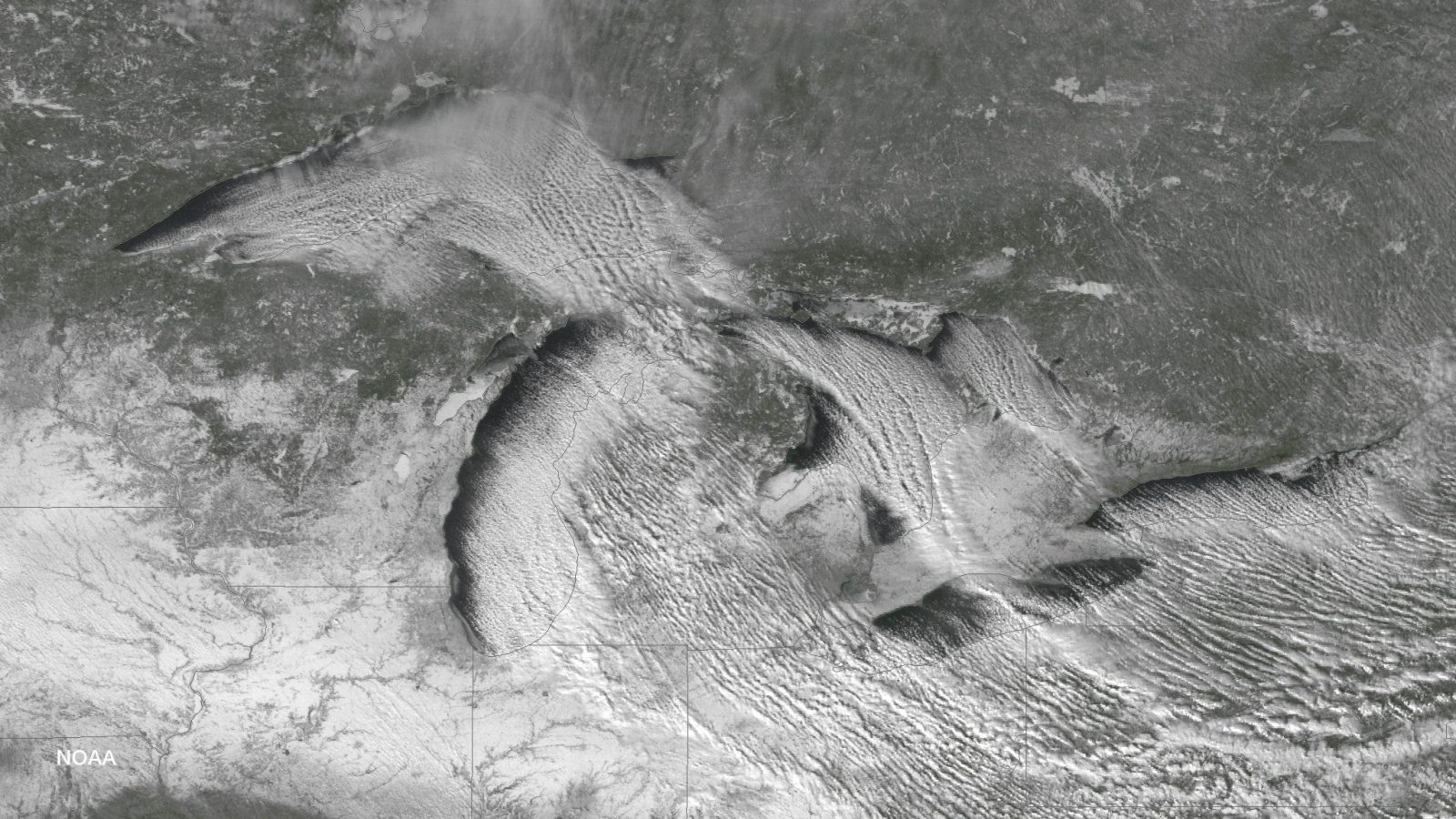
Direct answer: Lake-effect snow forms when cold, dry air passes over a large, relatively warm lake, picks up heat and moisture, and rises into narrow cloud bands that can drop 2 to 3 inches of snow per hour or more. It is common across the Great Lakes region during late fall and winter. The bands are narrow and wind-driven, so one town can be buried while the sun shines just a mile or two away, and in Canada the same phenomenon triggers snow squall warnings.
How lake-effect snow works
The recipe has three ingredients: very cold air (often arriving from Canada), open lake water that is warmer than the air, and wind to carry the result ashore. As the cold air moves across the water, warmth and moisture transfer into the lowest part of the atmosphere. The air rises, clouds build, and a narrow band of intense snow forms downwind of the lake. The National Weather Service notes these bands commonly produce 2 to 3 inches of snow per hour or more.
The most dangerous form is the lake-effect snow squall: a local, intense, narrow band of moderate to heavy snow that can extend long distances inland and persist for many hours, sometimes with strong gusty winds and even lightning. NOAA describes snow squalls as brief periods of intense snowfall and wind that lead to whiteout conditions, zero visibility and a possible flash freeze. They are most common in the northern US, especially around the Great Lakes, between November and March.
Where it hits hardest: the snowbelts
The heaviest snow falls in "snowbelts", the strips of land just downwind of each lake where the bands come ashore again and again:
- East of Lake Ontario: the Tug Hill Plateau and Jefferson, Lewis and Oswego counties, including Watertown, New York, all named in National Weather Service lake-effect archives.
- Off Lake Erie: areas south of Buffalo, Erie County, and the Chautauqua Ridge in Chautauqua and Cattaraugus counties.
- Michigan and western New York: northern Michigan and the Buffalo area. In a December 2024 event, Munising and Gaylord in Michigan recorded 14 and 17 inches, while Elma Center near Buffalo recorded 38 inches.
- Canada: the shores of Lake Huron and southern Georgian Bay, and eastern Lake Superior, including the Sault Ste. Marie area of Ontario.
The warnings that cover it
In the US, the National Weather Service issues a Lake Effect Snow Warning when pure lake-effect snow, meaning snow that is a direct result of the lake effect rather than a larger low-pressure system, may pose a hazard or is life-threatening. There is no single national snowfall threshold; criteria are set locally. One NWS office, in Cleveland, uses 6 inches or more of lake-effect accumulation. Broader winter systems are covered by Winter Storm Watches and Warnings instead.
In Canada, Environment and Climate Change Canada issues snow squall watches and snow squall warnings for the same kind of event. A typical warning says visibility will be suddenly reduced to near zero at times in heavy snow and blowing snow, travel will be particularly hazardous, and conditions can change quickly. Since November 2025 Canada has used colour-coded yellow, orange and red impact-based alerts.
What to do
Lake-effect snow's danger is its suddenness: visibility can collapse to near zero in minutes on a road that was clear moments before. The National Weather Service's advice for a snow squall warning is blunt: avoid or delay motor travel until the squall passes, because there is truly no safe place on the highway during a snow squall. If you are already driving and cannot get off the road in time, reduce your speed, turn on your headlights and hazard lights, leave plenty of distance to the car ahead, and do not slam on your brakes.
Before the season, keep a winter kit in your vehicle with blankets, a shovel, food, water and a torch, and tell someone your route before long drives through snowbelt country. During any heavy snow event, stay indoors if you can, and check on older neighbours who may be at risk if the power fails.
Related pages on this site: Severe Cold & Winter Storm Safety for hypothermia, frostbite and stranded-driver guidance, US weather alerts by state to see the warnings in force now, and the historical disaster archive.
Frequently asked questions
How is lake-effect snow different from a normal winter storm?
A Lake Effect Snow Warning is issued when the snow is a direct result of the lake effect rather than a larger low-pressure system. The snow falls in narrow, intense, wind-driven bands instead of across a broad area.
When is lake-effect snow season?
Late fall and winter, according to the National Weather Service. NOAA says snow squalls are most common around the Great Lakes between November and March.
What should I do if I am driving when a snow squall hits?
Avoid or delay travel until it passes: the National Weather Service says there is no safe place on the highway during a snow squall. If you cannot exit, slow down, turn on headlights and hazard lights, keep your distance, and do not slam on your brakes.
Does Canada issue warnings for lake-effect snow?
Yes. Environment and Climate Change Canada issues snow squall watches and warnings for areas such as the Lake Huron and Georgian Bay shores, and since November 2025 its alerts are colour-coded yellow, orange or red by expected impact.
Sources
- National Weather Service - Glossary (Lake Effect Snow)
- National Weather Service - Lake-Effect Snow safety
- National Weather Service - Snow Squall safety
- NOAA - 4 tips to keep you safe during a snow squall
- National Weather Service Cleveland - Watch/Warning/Advisory criteria
- National Weather Service Buffalo - Lake-effect event archive
- NASA Earth Observatory - Wintry weather whooshes in
- Environment and Climate Change Canada - Weatheradio event codes
- Environment and Climate Change Canada - Snow squall warning text
About the author
WND Editorial Team — The World Natural Disasters editorial team curates disaster information from official scientific and humanitarian sources, reviews safety guidance against public-agency recommendations, and maintains the historical database.
Written and reviewed under our editorial policy. Factual claims cite the sources listed above.
Found an error? See our corrections policy.