Derechos: The Straight-Line Winds That Hit Like a Hurricane
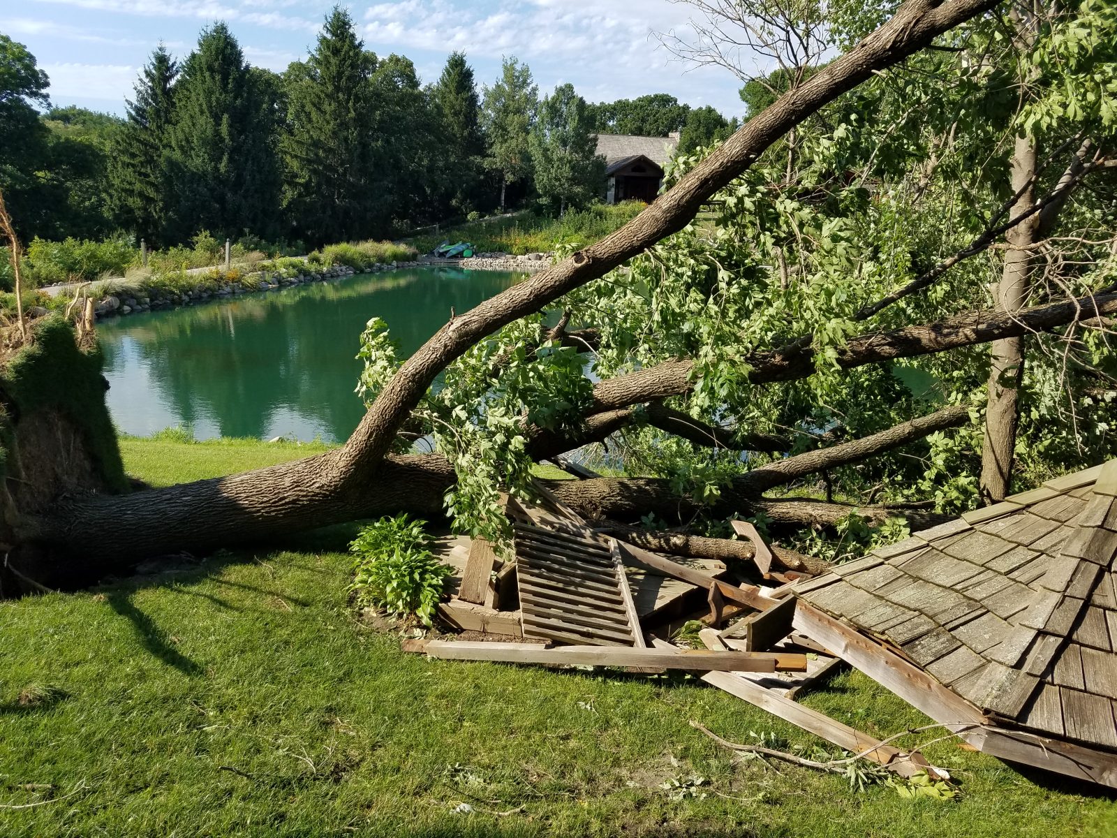
Direct answer: A derecho (pronounced "deh-REY-cho") is a widespread, long-lived severe windstorm produced by a fast-moving line of thunderstorms. Unlike a tornado, its winds are straight-line, with no rotation, but they can still top 100 mph — flattening buildings, snapping power lines and killing. If a severe thunderstorm warning is issued, treat it with the same urgency as a tornado warning: get indoors, away from windows, and stay there until the storm passes.
What a derecho is — the current definition
"Derecho" is Spanish for "straight ahead." The term was coined in 1888 by Dr. Gustavus Hinrichs, a University of Iowa physics professor, to distinguish thunderstorm straight-line winds from tornadoes' rotary winds, and revived in a 1987 paper by meteorologists Robert Johns and William Hirt.
In April 2026 the Storm Prediction Center updated its definition: a storm system may be classified as a derecho if the damage swath extends at least 250 miles (about 400 km), with gusts of at least 58 mph (93 km/h) along its length, several well-separated gusts of 75 mph (121 km/h) or more, and a thunderstorm cluster moving faster than the mean wind — driven mainly by its own pool of cold air. Some National Weather Service pages still carry the older 240-mile wording.
Downbursts, microbursts and macrobursts — the building blocks
Every derecho is built from smaller pieces. A downburst is the general term for strong, localized winds: a thunderstorm's downdraft — a sinking column of air dragged down by precipitation — hits the ground and spreads outward in a straight line. Downbursts can exceed 100 mph.
A microburst is a small, short-lived downburst — less than 4 km across, lasting five to ten minutes, with winds sometimes exceeding 100 mph. A macroburst is larger than 4 km and can damage like a tornado. Derechos are, in the Storm Prediction Center's words, "made up of families of downburst clusters" extending continuously for at least 250 miles.
The key difference from a tornado is rotation: straight-line wind is any thunderstorm wind not associated with rotation. Derecho damage typically runs in one direction along a relatively straight path. That said, tornadoes can occur inside the same storm system as a derecho.
How strong they get — the official records
Official records include a measured 128 mph gust in eastern Wisconsin on 31 May 1998 (estimated 130 mph in Lower Michigan) and 115 mph in northern Wisconsin on 4 July 1977. The 29 June 2012 derecho raced from Iowa to the Mid-Atlantic coast at nearly 60 mph, traveling more than 700 miles and killing at least 20 people. Officially recorded gusts that night included 91 mph at Fort Wayne, Indiana, 82 mph at Dayton, Ohio, 71 mph at Dulles, 70 mph at Reagan National and 66 mph at Baltimore-Washington airports.
Derecho-producing storms typically move at 50 mph or more — a few have been clocked at 70 mph — which is why they can arrive with frighteningly little notice. More than three-quarters of US derechos occur between April and August.
Watches, warnings and the "particularly dangerous" label
The Storm Prediction Center issues Severe Thunderstorm Watches when hail of at least 1 inch or damaging winds are expected over the next two to eight hours; your local National Weather Service office issues the warnings — severe weather observed or expected within the hour. For exceptionally intense derechos, a watch can carry "Particularly Dangerous Situation" wording. Forecasting derechos remains one of the hardest tasks in operational meteorology, and because the storms move so fast, darkening skies can appear on very short notice.
What to do
The safest place during high winds is indoors: a modern enclosed building or a metal-topped vehicle, away from windows, electrical appliances, plumbing and corded telephones. Before the storm, bring in or secure anything that can blow away — patio furniture, garbage cans, loose roofing — remove dead trees or overhanging branches near structures, and shutter windows.
Caught outside, take cover next to a building or under a shelter, and stay clear of roadways and train tracks — a gust can blow you into traffic. Get off lakes and reservoirs: high winds can capsize boats. Mobile homes in particular may be overturned or destroyed, the Storm Prediction Center warns, so move to a sturdy building when a severe thunderstorm warning is issued.
Driving: keep both hands on the wheel, slow down and keep your distance — gusts can push a car outside its lane. High-profile vehicles — trucks, vans, SUVs, trailers — are the most vulnerable. If the wind makes driving unsafe, pull onto the shoulder away from trees or anything tall that could fall, stay in the car and turn on your hazard lights until it subsides.
After the storm, stay away from downed power lines and anything touching them — vehicles, tree branches. If a line falls on your car, stay inside until help arrives; if you must get out because of fire, jump clear without touching any metal part of the car. Report downed lines to your utility and the police, and never try to move debris near them yourself. Falling trees bring live lines down with them, so the electrocution risk is real — especially at night, with the power out.
Related pages on this site: US weather alerts by state to see the warnings in force now, and the historical disaster archive.
Frequently asked questions
How is a derecho different from a tornado?
A tornado's winds rotate; a derecho's winds blow in straight lines. Derecho damage typically runs in one direction along a relatively straight path, which is why it is sometimes called straight-line wind damage. The two can occur together: tornadoes sometimes form inside the same storm system that produces a derecho.
What is the difference between a derecho, a downburst and a microburst?
A downburst is the general term for strong winds from a thunderstorm downdraft hitting the ground. A microburst is a small, short-lived downburst — under 4 km across, lasting five to ten minutes. A derecho is far bigger: families of downburst clusters stretching damage continuously for at least 250 miles.
What should I do if a severe thunderstorm warning is issued while I am driving?
Slow down, keep both hands on the wheel and keep your distance from other vehicles — gusts can push a car outside its lane. If the wind makes driving unsafe, pull onto the shoulder away from trees or anything tall that could fall, stay in the car and turn on your hazard lights until the wind subsides.
How much advance warning will I get?
Often very little. Derecho storms typically move at 50 mph or more, so darkening skies can appear on very short notice, and the Storm Prediction Center calls derechos one of the hardest phenomena to forecast. A Severe Thunderstorm Watch means damaging winds are possible in the next few hours; a warning means they have been observed or are expected within the hour.
Sources
- NOAA/NWS Storm Prediction Center - Facts About Derechos
- NOAA/NWS Storm Prediction Center - FAQ
- National Weather Service - Thunderstorm Winds and Derechos
- NWS Baltimore/Washington - The Derecho of June 29, 2012
- NOAA National Severe Storms Laboratory - Severe Weather 101: Damaging Winds Types
- NWS Melbourne - High Wind Safety Rules
About the author
WND Editorial Team — The World Natural Disasters editorial team curates disaster information from official scientific and humanitarian sources, reviews safety guidance against public-agency recommendations, and maintains the historical database.
Written and reviewed under our editorial policy. Factual claims cite the sources listed above.
Found an error? See our corrections policy.