Atmospheric Rivers: Rivers in the Sky and Their Hidden Dangers
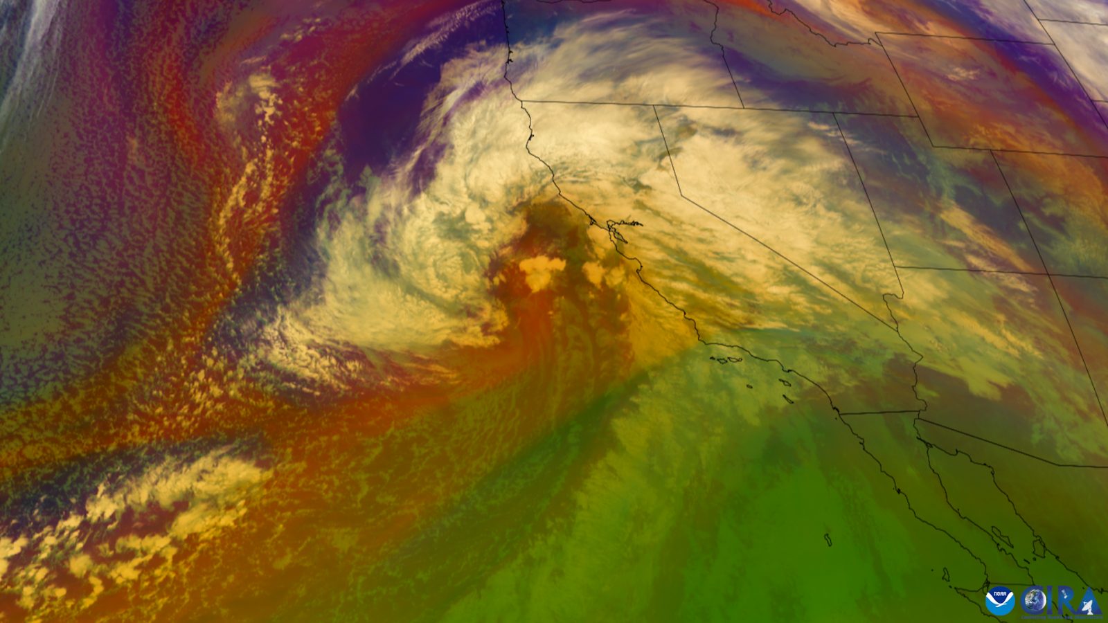
Direct answer: An atmospheric river is a long, narrow stream of water vapor moving through the sky — "much like a river is water moving over land, an atmospheric river is a stream of water vapor moving in the sky," in the words of NOAA. About 250 to 375 miles wide and more than 1,000 miles long, these rivers in the sky deliver 30 to 50 percent of the U.S. West Coast's annual water supply — but strong ones bring serious flooding and mudslides, especially in California during the winter months.
What an atmospheric river actually is
NOAA describes atmospheric rivers as "long, narrow conveyor belts of moisture that move through the atmosphere." They usually begin over tropical regions: warm temperatures cause ocean water to evaporate and rise, and strong winds carry the water vapor through the atmosphere. When an atmospheric river moves over land, the water vapor rises farther into the atmosphere, cools into water droplets, and falls as precipitation — rain at lower elevations, snow up high.
One famous example is the "Pineapple Express," which picks up warm, moist air near Hawaii. When it hits land in the western United States and Canada, NOAA says, it can cause heavy rain and snow — in California, up to 5 inches of rain in a day. These systems are sometimes called "drought-busters": atmospheric rivers have ended up to three-quarters of the droughts in the Pacific Northwest from 1950 to 2010. Water manager's blessing, flood forecaster's headache — it depends on strength.
The 1-to-5 AR scale
Atmospheric rivers are ranked on a scale of 1 to 5, developed by F. Martin Ralph of the Center for Western Weather and Water Extremes at Scripps Institution of Oceanography together with the National Weather Service, and announced by the USGS in February 2019. The categories run from "weak" to "moderate," "strong," "extreme," and "exceptional." The ranking is based on the amount of water vapor within the atmospheric river over a 24- to 48-hour window — a shorter burst gets demoted a category, a longer one promoted.
In plain terms: Category 1 (Weak) is primarily beneficial. Category 2 (Moderate) is mostly beneficial but somewhat hazardous. Category 3 (Strong) is a balance of beneficial and hazardous — the October 14–15, 2016 storm dropped 5 to 10 inches of rain and pushed rivers near flood stage. Category 4 (Extreme) is mostly hazardous — the January 8–9, 2017 storm put up to 14 inches of rain in the Sierra Nevada and left at least a dozen rivers at flood stage. Category 5 (Exceptional) is primarily hazardous.
Why strong atmospheric rivers are dangerous
NOAA warns that strong atmospheric rivers "can lead to serious flooding and mudslides, especially in California." The mudslide danger is worst where wildfires have burned recently. The USGS calls fast-moving debris flows triggered by intense rainfall "one of the most dangerous post-fire hazards": in southern California, as little as 7 millimeters — 0.3 inches — of rainfall in 30 minutes has triggered debris flows, and any storm with intensities above about 10 millimeters per hour poses a risk. It takes much less rainfall to trigger debris flows from burned basins than from unburned areas.
When burn scars are threatened, authorities have warned that debris flows of rushing mud, rocks, or vegetation "may sound like cracking, roaring, or even a freight train," and residents were told not to attempt to cross a debris flow and to take shelter on the highest floor of their homes. The National Weather Service adds: even moderate rainfall rates can cause significant flooding in the first few years after a forest fire — if you are in or near a burn scar, plan ahead and be aware of the weather.
Staying safe when one arrives
Know the flood alert terms. The National Weather Service puts it simply: "A Flood WATCH means Be Prepared. A Flood WARNING means Take Action!" A Flash Flood or Flood Watch means flooding is possible — be alert and ready to evacuate on a moment's notice. A Warning means flash flooding has been reported or is imminent — act quickly to save yourself, because you may have only seconds.
And the rule that applies to every flood, whatever its cause: "Turn Around, Don't Drown." The National Weather Service warns that it only takes 6 inches of fast-moving water to knock over and carry away an adult, and 12 inches to carry away a small car — and most flooding deaths occur in vehicles. Do not walk through moving water; six inches can knock you down.
Related pages on this site: US weather alerts by state, the history of major storms, and the Tropical Cyclone Outlook for the current hurricane season picture.
Frequently asked questions
What is an atmospheric river?
A long, narrow stream of water vapor moving through the sky — NOAA says, “much like a river is water moving over land, an atmospheric river is a stream of water vapor moving in the sky.” They are about 250 to 375 miles wide, more than 1,000 miles long, and deliver roughly 30 to 50 percent of the U.S. West Coast’s annual water supply.
What is the Pineapple Express?
A well-known atmospheric river that picks up warm, moist air near Hawaii. When it hits land in the western U.S. and Canada, it can cause heavy rain and snow — in California, up to 5 inches of rain in a day. (NOAA)
What do the atmospheric river categories 1 to 5 mean?
The scale, developed by Scripps’ Center for Western Weather and Water Extremes with the National Weather Service, ranks atmospheric rivers from weak to exceptional: Cat 1 is primarily beneficial, Cat 3 is a balance of beneficial and hazardous, and Cat 5 is primarily hazardous.
Why are atmospheric rivers dangerous after wildfires?
Burned slopes shed water instead of absorbing it. The USGS says as little as 0.3 inches of rain in 30 minutes has triggered debris flows in southern California. Never try to cross a debris flow; take shelter on the highest floor of your home.
Sources
- NOAA NESDIS - What Is an Atmospheric River?
- NOAA NESDIS - Earth From Orbit: Atmospheric River Hits the West Coast
- NOAA GOES-R - Keeping an Eye on Rivers in the Sky
- USGS - Post-Fire Flooding and Debris Flow
- National Weather Service - Be Prepared: Flooding
About the author
WND Editorial Team — The World Natural Disasters editorial team curates disaster information from official scientific and humanitarian sources, reviews safety guidance against public-agency recommendations, and maintains the historical database.
Written and reviewed under our editorial policy. Factual claims cite the sources listed above.
Found an error? See our corrections policy.