Earthquake United States
The 1999 Hector Mine Earthquake
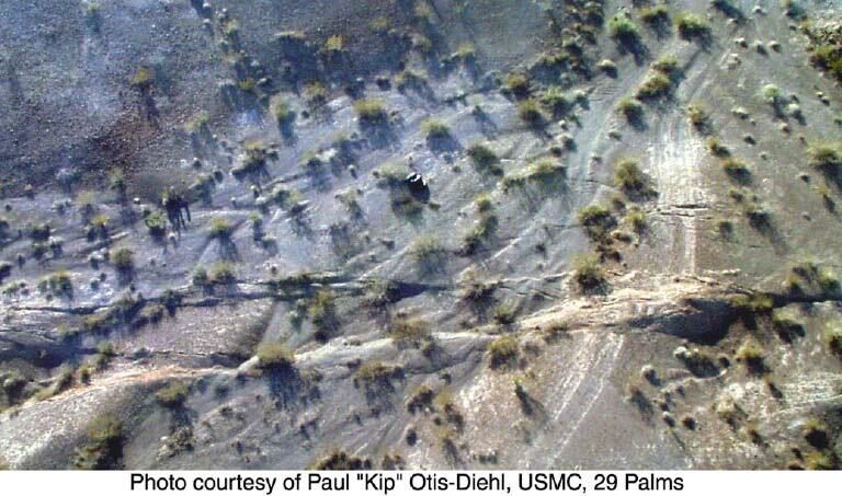
At 2:46 on the morning of Saturday 16 October 1999, a magnitude 7.1 earthquake struck the Mojave Desert in Southern California. The US Geological Survey's preliminary report places the epicentre at 34.59°N 116.27°W, about 47 miles east-southeast of Barstow, at a depth of 5 ± 3 km. Twelve small foreshocks, magnitudes 1.9 to 3.8, had rattled the same spot in the twelve hours before the mainshock.
Because the fault ruptured under empty desert, the USGS reports that damage was minimal and the societal impact minimal — a magnitude 7.1 earthquake that was barely a disaster, because almost nothing stood above it. The ground itself told the bigger story: 48 km of right-lateral surface rupture tore across the desert floor, beginning on two branches of the Lavic Lake fault and spreading south onto the Bullion fault, with the ground offset by as much as 5.25 ± 0.85 metres.
The quake's seismic waves also made distant faults slip — surface fracturing appeared along the southern San Andreas, Superstition Hills and Imperial faults, 100 to 200 km from the epicentre. It was at least the eighth such triggered-slip event in the Salton Trough in 31 years, a reminder that one earthquake can disturb faults far beyond its own rupture.
Hector Mine struck seven years after, and about 30 km east of, the 1992 magnitude 7.3 Landers earthquake, inside the Eastern California Shear Zone — a broad zone of faults that the USGS says carries about 15% of the Pacific–North American plate motion. It was felt widely across Southern California, southern Nevada, western Arizona and northern Baja California.
The lesson of Hector Mine is that magnitude is only half the story: where the fault breaks, and what stands above it, decides whether an earthquake is a curiosity or a catastrophe. The same 7.1 under a city would have been a very different morning. Earthquake readiness — Drop, Cover, and Hold On, an emergency kit, and the annual Great ShakeOut drill — applies wherever faults are, even when the last quake hit empty desert.
Sources & references
- USGS - Preliminary report on the 16 October 1999 M 7.1 Hector Mine earthquake
- USGS/Treiman et al. (2002) - Primary surface rupture of the Hector Mine earthquake
- USGS - Triggered surface slips in the Salton Trough
- Caltech/BSSA - The Hector Mine Earthquake of 16 October 1999: Introduction
- USGS - Surface rupture photo (public domain)
Impact figures
| Fatalities | unknown |
|---|
Figures per cited sources; estimates for older events vary.