Severe Hurricane / Cyclone / Typhoon ● Closed
Tropical Storm Warning issued October 9 at 10:31PM CDT by NWS Jackson MS, United States of America
Loading live data… · Marker positions are approximate; severity is labelled in each popup. Sources: USGS, GDACS, NASA EONET, NOAA/NWS, EMSC.
* WIND
- LATEST LOCAL FORECAST: Below tropical storm force wind
- Peak Wind Forecast: 15-25 mph with gusts to 45 mph
- THREAT TO LIFE AND PROPERTY THAT INCLUDES TYPICAL FORECAST
UNCERTAINTY IN TRACK, SIZE AND INTENSITY: Wind less than 39 mph
- The wind threat has remained nearly steady from the
previous assessment.
- PLAN: The sustained wind should remain less than tropical
storm force. Conditions may still be gusty.
- PREPARE: Listen for any instructions from local officials.
- ACT: Ensure emergency readiness should the forecast change.
- REALIZED IMPACTS: Being Assessed
- Little to no additional wind impacts expected. Community
officials are now assessing the extent of actual wind
impacts accordingly.
* FLOODING RAIN
- LATEST LOCAL FORECAST:
- Peak Rainfall Amounts: No additional significant rainfall
forecast
- THREAT TO LIFE AND PROPERTY THAT INCLUDES TYPICAL FORECAST
UNCERTAINTY IN TRACK, SIZE AND INTENSITY: Potential for
localized flooding rain
- The flooding rain threat has remained nearly steady from
the previous assessment.
- PLAN: Emergency plans should include the potential for
localized flooding from heavy rain.
- PREPARE: Consider protective actions if you are in an area
vulnerable to flooding.
- ACT: Heed any flood watches and warnings.
- POTENTIAL IMPACTS: Limited
- Localized rainfall flooding may prompt a few evacuations.
- Rivers and tributaries may quickly rise with swifter
currents. Small streams, creeks, canals, and ditches may
become swollen and overflow in spots.
- Flood waters can enter a few structures, especially in
usually vulnerable spots. A few places where rapid ponding
of water occurs at underpasses, low-lying spots, and poor
drainage areas. Several storm drains and retention ponds
become near-full and begin to overflow. Some brief road and
bridge closures.
* TORNADO
- LATEST LOCAL FORECAST:
- Situation is unfavorable for tornadoes
- THREAT TO LIFE AND PROPERTY THAT INCLUDES TYPICAL FORECAST
UNCERTAINTY IN TRACK, SIZE AND INTENSIT
Measurements
| Coordinates | 31.5943, -89.1556 |
|---|---|
| Region | Jones |
| Location Precision | polygon |
| Issuing Authority | United States of America — us-noaa-nws-en |
| Cap Urgency | Immediate |
| Cap Certainty | Likely |
| Cap Expires | 2026-10-10T06:45:00-05:00 |
Official source
Warnings courtesy of the issuing national meteorological service, via the WMO Alert Hub.
This is an official warning issued by the authority named above. Follow its instructions and those of your local emergency services.
Severity as published by WMO Alert Hub (national weather services).
View original reportAlso reported by: NWS NWS
This event as JSON · API and licence
Source updated 9 days ago (Oct 10, 2026 03:34 UTC) · we last heard from WMO Alert Hub (national weather services) 10 seconds ago
On a slow connection? Low-bandwidth version — no map, no scripts, under 14 KB.
Satellite view, before and after
The latest clear Sentinel-2 pass before this event and the earliest one after it.
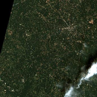
8 Oct 2026, the day before this event. 13.9% cloud across the tile.
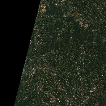
13 Oct 2026, 4 days after this event. 0% cloud across the tile.
The white ring marks where the event was reported.
Each image is a preview of a whole Sentinel-2 tile — an area of roughly 110 by 110 km, where one pixel is about 320 metres — not a close-up of the event, which may be a small part of it. "Clear" means under 30% cloud across the entire tile, so the exact place that matters can still be hidden. These are pictures for context, not an assessment of damage.
Contains modified Copernicus Sentinel data 2026, found through the Earth Search catalogue (Element 84) and served from the AWS Open Data Sentinel-2 archive.
Official authorities in United States
If you are there, these are the bodies whose instructions apply. This site is not an emergency service and does not issue warnings.
More for United States →What to do
Follow the instructions issued by WMO Alert Hub (national weather services) and your local emergency services. The guidance below is background.
Preparing for hurricane season, understanding watches vs warnings, storm surge evacuation, and riding out the storm safely.
Open Hurricane Safety Guide →Earlier hurricane / cyclone / typhoon events in United States
Severe and extreme events of the same kind, before this one. Listed for scale, not because they are connected to it.
Nearby & related events
Disclaimer: figures are automatic feeds from the named agencies and may be revised. Do not use this page for life-safety decisions — follow official local emergency services.