Severe Flood ● Closed
Tanzania: Floods and Landslides - Mar 2026
Loading live data… · Marker positions are approximate; severity is labelled in each popup. Sources: USGS, GDACS, NASA EONET, NOAA/NWS, EMSC.
In late March 2026, prolonged and intense rainfall associated with the March–May rainy season caused severe flooding and landslides in the Mbeya Region, located in Tanzania’s Southern Highlands. The most affected area was Rungwe District, where continuous heavy rains saturated the soil, triggering multiple landslides and flash floods.
The disaster occurred primarily between the evening of 25 March and the early hours of 26 March 2026, with heavy rainfall reported for several consecutive hours. According to local authorities and media reports, the rains were accompanied by strong winds, significantly worsening ground instability and surface runoff.
The worst‐affected wards were Nkunga, Lupepo, Kawetele and Ikuti in Rungwe District. Landslides swept through these communities, burying houses constructed mainly of mud bricks and corrugated iron sheets, while flooding damaged access roads and public infrastructure.
As of 27 March 2026, official reports confirmed that at least 20 people had lost their lives, the majority of whom were children, and several others were injured. Search and rescue operations were ongoing amid continued rainfall, with concerns about secondary landslides and further flooding. ([IFRC, 10 Apr 2026](https://reliefweb.int/node/4206996))
Measurements
| Coordinates | -6.2700, 34.8200 |
|---|---|
| Region | United Republic of Tanzania |
| Reliefweb Status | past |
| Reliefweb Type | Flood |
Reported by
Disaster reports from ReliefWeb, a service of UN OCHA
This is situation reporting from a humanitarian organisation, not a warning issued to the public.
Not rated by source. ReliefWeb (UN OCHA) does not publish a severity for this; the level shown is our own classification.
View original reportThis event as JSON · API and licence
Source updated 10 minutes ago (Oct 19, 2026 23:24 UTC) · we last heard from ReliefWeb (UN OCHA) 10 minutes ago
On a slow connection? Low-bandwidth version — no map, no scripts, under 14 KB.
What has changed
- Marked as ended by the source — Sep 9, 18:54 UTC by ReliefWeb (UN OCHA)
- Reopened by the source — Sep 9, 18:38 UTC by ReliefWeb (UN OCHA)
- Marked as ended by the source — Sep 9, 08:58 UTC by ReliefWeb (UN OCHA)
Figures published in the first minutes of an event are preliminary. A change here is the agency refining its own estimate, not a correction to this page.
Satellite view, before and after
The latest clear Sentinel-2 pass before this event and the earliest one after it.
24 Apr 2026, 5 days before this event. 23.5% cloud across the tile.
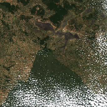
7 May 2026, 8 days after this event. 14.8% cloud across the tile.
The white ring marks where the event was reported.
Each image is a preview of a whole Sentinel-2 tile — an area of roughly 110 by 110 km, where one pixel is about 320 metres — not a close-up of the event, which may be a small part of it. "Clear" means under 30% cloud across the entire tile, so the exact place that matters can still be hidden. These are pictures for context, not an assessment of damage.
Contains modified Copernicus Sentinel data 2026, found through the Earth Search catalogue (Element 84) and served from the AWS Open Data Sentinel-2 archive.
Official authorities in Tanzania
If you are there, these are the bodies whose instructions apply. This site is not an emergency service and does not issue warnings.
More for Tanzania →General safety information
No authority has issued instructions for this event. The guidance below is general background reading, not a response to it.
Flood preparation, evacuation decisions, and the dangers of driving or walking through floodwater.
Open Flood Safety Guide →Nearby & related events
Disclaimer: figures are automatic feeds from the named agencies and may be revised. Do not use this page for life-safety decisions — follow official local emergency services.