Severe Flood ● Active
Flood Warning issued November 2 at 4:33PM EST until November 2 at 6:45PM EST by NWS Melbourne FL, United States of America
Loading live data… · Marker positions are approximate; severity is labelled in each popup. Sources: USGS, GDACS, NASA EONET, NOAA/NWS, EMSC.
* WHAT...Flooding caused by excessive rainfall continues.
* WHERE...Southeastern Indian River County in east central Florida...
Northeastern Martin County in east central Florida...
Central St. Lucie County in east central Florida...
* WHEN...Until 645 PM EST.
* IMPACTS...Flooding of rivers, creeks, streams, and other low-lying
and flood-prone locations is imminent or occurring. Expect many
areas of slow moving or standing water.
* ADDITIONAL DETAILS...
- At 433 PM EST, Doppler radar indicated heavy rain due to
thunderstorms. Flooding is already occurring in the warned area.
Between 6 and 12 inches of rain have fallen.
- Additional rainfall amounts of 2 to 4 inches are possible in the
warned area.
- Some locations that will experience flooding include...
Port Saint Lucie, Walton, Fort Pierce, Stuart, Vero Beach, Indian
River Shores, White City, Fort Pierce Inlet, Indrio, Saint Lucie
Nuclear Power Plant, Vero Beach South, Jensen Beach, Gifford,
Palm City, Sewall's Point, Fort Pierce South, Fort Pierce North,
Saint Lucie Airport, Saint Lucie Village and Indian River
Estates.
- http://www.weather.gov/safety/flood
Measurements
| Coordinates | 27.4338, -80.3019 |
|---|---|
| Region | Indian River, FL; Martin, FL; St. Lucie, FL |
| Location Precision | polygon |
| Issuing Authority | United States of America — us-noaa-nws-en |
| Cap Urgency | Expected |
| Cap Certainty | Likely |
| Cap Expires | 2026-11-02T18:45:00-05:00 |
Official source
Warnings courtesy of the issuing national meteorological service, via the WMO Alert Hub.
This is an official warning issued by the authority named above. Follow its instructions and those of your local emergency services.
Severity as published by WMO Alert Hub (national weather services).
View original reportThis event as JSON · API and licence
Source updated 1 hour ago (Nov 2, 2026 21:34 UTC) · we last heard from WMO Alert Hub (national weather services) 1 minute ago
On a slow connection? Low-bandwidth version — no map, no scripts, under 14 KB.
Satellite view, before and after
The latest clear Sentinel-2 pass before this event and the earliest one after it.
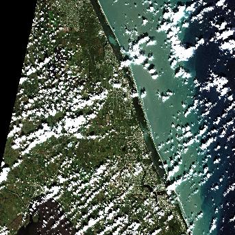
26 Oct 2026, 7 days before this event. 21.1% cloud across the tile.
No clear pass yet. Sentinel-2 revisits every few days and cloud can hide a place for longer — this event is less than a day old, and a clear scene will appear here once one exists.
The white ring marks where the event was reported.
Each image is a preview of a whole Sentinel-2 tile — an area of roughly 110 by 110 km, where one pixel is about 320 metres — not a close-up of the event, which may be a small part of it. "Clear" means under 30% cloud across the entire tile, so the exact place that matters can still be hidden. These are pictures for context, not an assessment of damage.
Contains modified Copernicus Sentinel data 2026, found through the Earth Search catalogue (Element 84) and served from the AWS Open Data Sentinel-2 archive.
Airports within 200 km, as the FAA reports them
-
DJT President Donald J. Trump International Airport, West Palm Beach · 86 km away
Delays: departures 1 hour and 1 minute to 1 hour and 15 minutes, increasing. Reason given: weather: thunderstorms.
-
FLL Fort Lauderdale Hollywood International Airport · 152 km away
Ground stop until 6:15 pm EST. Reason given: thunderstorms.Ground delay programme: average 1 hour and 47 minutes, up to 5 hours and 9 minutes. Reason given: thunderstorms.Delays: departures 30 minutes to 44 minutes, decreasing. Reason given: traffic management: spacing between flights, weather.
-
OPF Miami-Opa Locka Executive Airport · 170 km away
Delays: departures 16 minutes to 30 minutes, increasing. Reason given: traffic management: spacing between flights, weather.
-
RSW Southwest Florida International Airport, Fort Myers · 175 km away
Delays: departures 1 hour and 1 minute to 1 hour and 15 minutes, increasing. Reason given: weather: thunderstorms.
-
FMY Page Field, Fort Myers · 181 km away
Delays: departures 1 hour and 1 minute to 1 hour and 15 minutes, increasing. Reason given: weather: thunderstorms.
-
MIA Miami International Airport · 182 km away
Ground stop until 6:00 pm EST. Reason given: thunderstorms.
The FAA reports each disruption and its own stated reason. This page does not say the event caused it. Check with your airline before travelling.
Status as of 22:42 UTC from the FAA National Airspace System status.
Official authorities in United States
If you are there, these are the bodies whose instructions apply. This site is not an emergency service and does not issue warnings.
More for United States →What to do
Follow the instructions issued by WMO Alert Hub (national weather services) and your local emergency services. The guidance below is background.
Flood preparation, evacuation decisions, and the dangers of driving or walking through floodwater.
Open Flood Safety Guide →Earlier flood events in United States
Severe and extreme events of the same kind, before this one. Listed for scale, not because they are connected to it.
Nearby & related events
Disclaimer: figures are automatic feeds from the named agencies and may be revised. Do not use this page for life-safety decisions — follow official local emergency services.