Severe Flood ● Closed
Ecuador: Floods - Jan 2026
Loading live data… · Marker positions are approximate; severity is labelled in each popup. Sources: USGS, GDACS, NASA EONET, NOAA/NWS, EMSC.
On 27 February, authorities declared a 90-day regional state of emergency across five coastal provinces - Guayas, Esmeraldas, Los Ríos, El Oro and Santa Elena - as heavy rains have continued to intensify. As of 26 February, authorities now report more than 1,079 adverse rain-related incidents across 24 provinces, affecting more than 19,335 people and displacing a further 1,314. In the hardest hit areas, flooding and landslides have damaged schools, roads and bridges, affected crops and livestock and are disrupting access to essential services, deepening vulnerabilities and humanitarian needs. ([OCHA, 27 Feb 2026](https://reliefweb.int/node/4200516))
According to the Ecuadorian Secretariat for Risk Management (SNGR), the death toll from the rainy season reached 17 fatalities by 20 April. A total of 103 370 people have been affected, 270 houses have been destroyed, and 30 933 houses damaged. The most affected provinces are Guayas, Los Ríos, Esmeraldas, and El Oro. ([ECHO, 22 Apr 2026.](https://reliefweb.int/node/4208779/))
The rainy season, which started on 1 January, has been affecting several parts of Ecuador, triggering 441 landslides, causing about 400 flood events, and resulting in casualties and damage. According to the national authorities, as of 1 March at least three people have died (one each in Chimborazo, Azuay and Cotopaxi provinces) while 14 others were injured and more than 21 000 people were affected across 24 provinces. The hardest‑hit province is Guayas, with over 10 000 people affected, followed by Esmeraldas (3 102) and El Oro (more than 2 300). In total, more than 5 400 houses have been impacted, of which 57 were destroyed. Authorities are monitoring the situation daily and have declared a regional emergency for the provinces of Guayas, Esmeraldas, El Oro, Los Ríos, Manabí, Santa Elena, Loja and Chimborazo. ([ECHO, 2 Mar 2026](https://reliefweb.int/node/4200647))
The rainy season continues to affect most of Ecuador, and as of 11 March it had ca
Measurements
| Coordinates | -1.1600, -78.4300 |
|---|---|
| Region | Ecuador |
| Reliefweb Type | Flood |
| Reliefweb Status | ongoing |
Reported by
Disaster reports from ReliefWeb, a service of UN OCHA
This is situation reporting from a humanitarian organisation, not a warning issued to the public.
Not rated by source. ReliefWeb (UN OCHA) does not publish a severity for this; the level shown is our own classification.
View original reportThis event as JSON · API and licence
Source updated 83 days ago (Jul 28, 2026 09:12 UTC) · we last heard from ReliefWeb (UN OCHA) 13 minutes ago
On a slow connection? Low-bandwidth version — no map, no scripts, under 14 KB.
Satellite view, before and after
The latest clear Sentinel-2 pass before this event and the earliest one after it.
No scene under 30% cloud in the 60 days before this event.
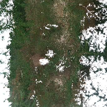
16 Mar 2026, 14 days after this event. 21.7% cloud across the tile.
The white ring marks where the event was reported.
Each image is a preview of a whole Sentinel-2 tile — an area of roughly 110 by 110 km, where one pixel is about 320 metres — not a close-up of the event, which may be a small part of it. "Clear" means under 30% cloud across the entire tile, so the exact place that matters can still be hidden. These are pictures for context, not an assessment of damage.
Contains modified Copernicus Sentinel data 2026, found through the Earth Search catalogue (Element 84) and served from the AWS Open Data Sentinel-2 archive.
Official authorities in Ecuador
If you are there, these are the bodies whose instructions apply. This site is not an emergency service and does not issue warnings.
More for Ecuador →General safety information
No authority has issued instructions for this event. The guidance below is general background reading, not a response to it.
Flood preparation, evacuation decisions, and the dangers of driving or walking through floodwater.
Open Flood Safety Guide →Nearby & related events
Disclaimer: figures are automatic feeds from the named agencies and may be revised. Do not use this page for life-safety decisions — follow official local emergency services.