Severe Flood ● Active
Congo: Floods - Oct 2026
Loading live data… · Marker positions are approximate; severity is labelled in each popup. Sources: USGS, GDACS, NASA EONET, NOAA/NWS, EMSC.
Between 9 and 10 October 2026, heavy rainfall caused flooding in several localities of the Likouala Department. The event affected four districts in Likouala: Épéna, Impfondo, Bétou and Dongou. According to preliminary data reported by the Congolese Red Cross, the floods affected a total of 28,135 people across the four districts, including 17,980 people in Épéna and Impfondo combined.
The reported consequences include the destruction or damage of houses, flooding or deterioration of roads, and the loss of agricultural crops, food stocks and fishing equipment. [...] The floods may also exacerbate health risks in a context marked by the presence of cholera in Likouala Department in 2026. According to World Health Organization data, 316 cholera cases had been recorded in the department as of 14 June 2026, representing 20.6% of all cases reported nationally at that time. ([IFRC, 25 Oct 2026](https://reliefweb.int/node/4235463/))
Measurements
| Coordinates | -0.3100, 15.9900 |
|---|---|
| Region | Congo |
| Reliefweb Status | ongoing |
| Reliefweb Type | Flood |
Reported by
Disaster reports from ReliefWeb, a service of UN OCHA
This is situation reporting from a humanitarian organisation, not a warning issued to the public.
Not rated by source. ReliefWeb (UN OCHA) does not publish a severity for this; the level shown is our own classification.
View original reportThis event as JSON · API and licence
Source updated 11 minutes ago (Nov 3, 2026 08:46 UTC) · we last heard from ReliefWeb (UN OCHA) 11 minutes ago
On a slow connection? Low-bandwidth version — no map, no scripts, under 14 KB.
Internet connectivity at the time
Internet connectivity in Congo (Republic) dropped 7 hours after this event, and stayed disrupted for about 55 minutes.
From 26 Oct 2026 06:55 UTC to 26 Oct 2026 07:50 UTC. Detected by global routing tables — networks withdrawn from the internet entirely.
Internet outages have many causes — damaged cables, power failures, network maintenance and deliberate shutdowns among them. IODA detects the loss of connectivity and does not attribute it to anything. This is shown because it happened at the same time, not because one caused the other.
Measured by IODA, Georgia Institute of Technology.
Satellite view, before and after
The latest clear Sentinel-2 pass before this event and the earliest one after it.
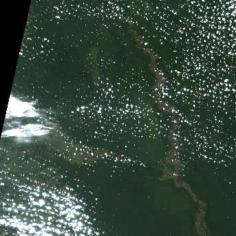
15 Sep 2026, 41 days before this event. 7.4% cloud across the tile.
No clear pass yet. Sentinel-2 revisits every few days and cloud can hide a place for longer — this event is 8 days old, and a clear scene will appear here once one exists.
The white ring marks where the event was reported.
Each image is a preview of a whole Sentinel-2 tile — an area of roughly 110 by 110 km, where one pixel is about 320 metres — not a close-up of the event, which may be a small part of it. "Clear" means under 30% cloud across the entire tile, so the exact place that matters can still be hidden. These are pictures for context, not an assessment of damage.
Contains modified Copernicus Sentinel data 2026, found through the Earth Search catalogue (Element 84) and served from the AWS Open Data Sentinel-2 archive.
General safety information
No authority has issued instructions for this event. The guidance below is general background reading, not a response to it.
Flood preparation, evacuation decisions, and the dangers of driving or walking through floodwater.
Open Flood Safety Guide →Nearby & related events
Disclaimer: figures are automatic feeds from the named agencies and may be revised. Do not use this page for life-safety decisions — follow official local emergency services.